- Home
- Beaches & Islands
- Pantai Dasar Sabak
Pantai Dasar Sabak
Pantai Dasar Sabak near Kota Bharu was one of the spots chosen by the Japanese Army to land its initial invasion force on 8th December 1941 during World War Two. The landing area here covered two sectors, the Badang zone near Pantai Cahaya Bulan and the Sabak zone which included this beach and the Pulau Pak Amat area.
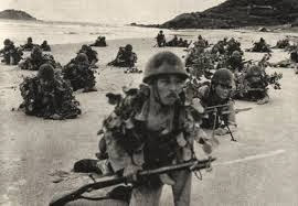
It is said that fighting here commenced an hour before the attack on Pearl Harbour began due to an error by the Japanese in calculating a time difference. This beach therefore saw the first fighting and casualties of the Pacific War.
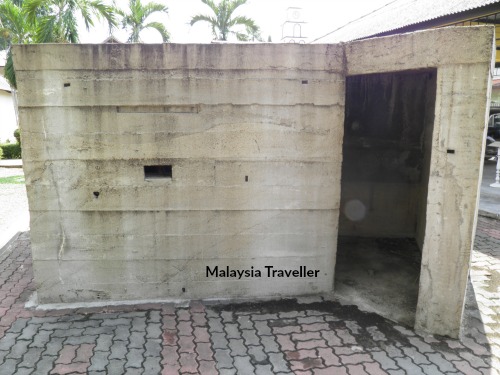 This replica of an allied beach pillbox can be found at the World War II Memorial in Kota Bharu.
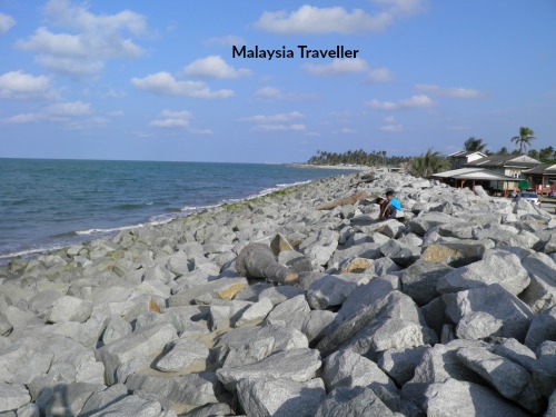
This stretch of beach used to have some old World War Two pillboxes but they have been washed away by the severe coastal erosion which has affected the majority of the Kelantan coastline in recent years. Today the beach has all gone and a wall of boulders has been built to protect the village and coast from further destruction.
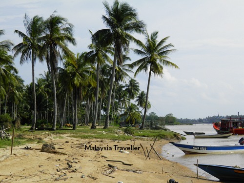
To get an idea of how Sabak used to look before the erosion you can drive further up the coast towards Badang where the above photo was taken.
How to Get To Pantai Dasar Sabak
What is left of this beach can be found near the mouth of the Raja Gali River just a couple of kilometres north east of Kota Bharu’s airport. Take Jalan Pantai Sabak until the end where it reaches the sea wall. There is a small village here called Kg Pantai Dasar.
I have marked the exact location on this interactive map:
GPS Co-ordinates:
6°10'42.4"N 102°19'19.7"E
6.178430, 102.322130
Nearby
- Home
- Beaches & Islands
- Pantai Dasar Sabak
Share this page:
AUTHOR BIO

David (the one on the left) is the writer behind Malaysia Traveller, sharing firsthand travel advice from over five decades of living and travelling across Asia and the Middle East. Based in Malaysia since 2009 and now in Kuching, he has published 700+ pages, personally visited every place he covers, and uses only his own photos. Readers can learn more on his About Me page. He also shares updates on Facebook and YouTube. He loves uncovering overlooked places even many Malaysians have never visited.
Recent Articles
-
Siniawan Old Town and Night Market
May 22, 26 12:14 AM
 Siniawan Old Town and Night Market is a small village with a Wild West feel and is a great place to eat and drink near Bau
 -
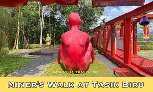
Miners Walk at Tasik Biru - Bau
May 20, 26 12:09 AM
 When in Bau be sure to take the Miners Walk at Tasik Biru to the Fu De Temple with its great views and quirky naked red man statue.
 -
BAS MY Kuching Bus Routes - 2026 Updates
May 16, 26 12:14 AM
 See the latest BAS MY Kuching Bus Routes, maps, fares and payment information for Kuching's pink buses.

Getting Around
- Free KL City Bus
- KL Hop-On Hop-Off
- BAS.MY Kuching
- BRT Sunway Line
- Malaysia By Coach
- Malaysia By Train
- Pangkor Ferry
- Marina Island Ferry
- Penang to Langkawi Ferry
- Visa Requirements
Hotels
CONTACT ME | PRIVACY POLICY | TRAVEL BLOG
Over 12 Million Unique Visitors Served Since 2011. Over 35 Million Page Visits. Statistics up to end April 2026.