- Home
- Top Langkawi Attractions
- Gunung Raya
Gunung Raya
Drive or Walk?

Gunung Raya is Langkawi's highest peak at around 872m (2,860 feet). This makes it the 225th tallest on my list of 300 Highest Malaysian Mountains.
It is one of the easiest to ascend because you can drive all the way up. If you prefer the exercise you can walk up - details below.
The mountain is roughly in the centre of the island and, from its peak, visitors can enjoy superb views over the whole of Langkawi and the surrounding seas.
There is a rather far-fetched local legend that the mountain is the petrified remains of a giant, a myth probably conceived in those far-off days when the villagers used to sit around the fire and drink too much coconut toddy.
 |
 |
Access to the peak is via a good tarmac road which joins Jalan Ulu Melaka.
At the start of the road is a toll booth where a toll of 50 sen is supposed to be payable but there was nobody on duty when I visited in February 2013.
The road winds its way up the mountain passing through thick forest and providing panoramic views whenever there is a clearing. Many bird species including hornbills are said to inhabit this area but I did not spot any hornbills.
The road is about 13 km long and it takes half an hour or more to reach the top by car.

At the summit there is a fenced-off complex of buildings used by the Government and off-limits to visitors. There is also a communications station and a number of tall masts have been erected on the peak.
For the visitor there is the D'Coconut Hill Resort which includes an observation tower which visitors are able to enter for a fee of RM10.
After paying, you take a lift and then walk up a flight of steps to the top deck of the observation tower.
Here there is a kind of lounge with comfortable seating and a wrap-around balcony from where you can take photos of the view provided the weather is good.
The ticket price includes a cup of ginger tea (delicious). Other drinks are available for a price.
There is not a lot else to do on Gunung Raya.

The D'Coconut Hill Resort looked rather run down and the swimming pool could do with a good clean. In fact it was difficult to tell if the resort was even operating but I see from various websites that they are still selling their rooms.
The resort looks like it was once an exclusive hotel and could be again with a little renovation but for now I would not recommend it.

Gunung Raya - The Steps
Just below the summit is a blue sign marking the point where the Tangga Helang Seribu Kenangan (roughly translated as Eagle Stairs Thousand Memories) starts and/or ends.
This is a flight of 4,287 steps built in 2000. The sign informs that the lowest step is at 55 metres above sea level and the highest step is 787 metres above sea level.
The distance covered is 3.1km and the estimated climbing time is 2 hours and 15 minutes.
The other end of the trail begins in Lubuk Semilang Park, close to Mardi Agrotechnology Park.
As you can see from this photo, the stairs are overgrown.

I toyed with the idea of walking up Gunung Raya instead of driving but the prospect of slippery, overgrown pathways and relentless steps was not so tempting especially as I would have to go back down by steps too.
For information on other Malaysian Mountains click here.
- Home
- Top Langkawi Attractions
- Gunung Raya
Share this page:
AUTHOR BIO

David (the one on the left) is the writer behind Malaysia Traveller, sharing firsthand travel advice from over five decades of living and travelling across Asia and the Middle East. Based in Malaysia since 2009 and now in Kuching, he has published 700+ pages, personally visited every place he covers, and uses only his own photos. Readers can learn more on his About Me page. He also shares updates on Facebook and YouTube. He loves uncovering overlooked places even many Malaysians have never visited.
Recent Articles
-
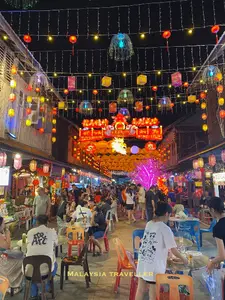
Siniawan Old Town and Night Market
May 22, 26 12:14 AM
 Siniawan Old Town and Night Market is a small village with a Wild West feel and is a great place to eat and drink near Bau
 -
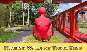
Miners Walk at Tasik Biru - Bau
May 20, 26 12:09 AM
 When in Bau be sure to take the Miners Walk at Tasik Biru to the Fu De Temple with its great views and quirky naked red man statue.
 -
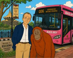
BAS MY Kuching Bus Routes - 2026 Updates
May 16, 26 12:14 AM
 See the latest BAS MY Kuching Bus Routes, maps, fares and payment information for Kuching's pink buses.
Getting Around
- Free KL City Bus
- KL Hop-On Hop-Off
- BAS.MY Kuching
- BRT Sunway Line
- Malaysia By Coach
- Malaysia By Train
- Pangkor Ferry
- Marina Island Ferry
- Penang to Langkawi Ferry
- Visa Requirements
Hotels
CONTACT ME | PRIVACY POLICY | TRAVEL BLOG
Over 12 Million Unique Visitors Served Since 2011. Over 35 Million Page Visits. Statistics up to end April 2026.